Introduction
GPS telemetry has emerged as a transformative tool for studying red panda movements and understanding their ecological needs. By equipping red pandas with lightweight GPS collars, researchers can collect precise data on their home ranges, habitat preferences, and seasonal migrations
This technology offers unparalleled insights into the spatial behaviors of this elusive species, informing conservation strategies to protect their shrinking habitats
In this article, we explore how GPS telemetry enhances red panda research, highlighting key findings, challenges, and applications in conservation
What Is GPS Telemetry and How Is It Used in Red Panda Research?
GPS telemetry is revolutionizing the study of red panda movements by providing detailed data on their spatial behavior
This technology enables researchers to track red pandas in their natural habitats, uncovering patterns that were previously difficult to observe due to the species’ elusive and arboreal nature
The Basics of GPS Telemetry in Wildlife Studies
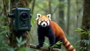
GPS telemetry involves equipping animals with lightweight collars or tags that use satellite signals to record their location over time. These devices collect data points at regular intervals, which are then transmitted to researchers for analysis
For red pandas, GPS collars are carefully designed to be lightweight and minimally invasive, ensuring they do not hinder the animal’s natural movements or behaviors
The technology allows researchers to map the movements of red pandas across their home ranges, revealing where they forage, rest, and travel
This data is especially valuable for understanding how red pandas interact with their environment, respond to seasonal changes, and navigate fragmented habitats
Deploying GPS Collars on Red Pandas
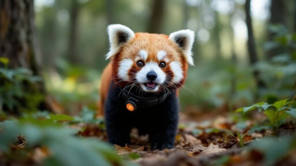
Attaching a GPS collar to a red panda requires careful planning to prioritize the animal’s welfare. Researchers typically capture red pandas using humane traps placed in areas where the animals are known to travel
Once captured, the animals are fitted with collars that weigh less than 5% of their body weight, meeting ethical standards for wildlife telemetry studies
The collars are programmed to collect data at intervals suited to the study’s goals, such as recording locations every hour or during specific times of activity. Some collars are equipped with accelerometers to capture additional data on movement intensity, providing insights into behaviors like climbing, foraging, or resting
After a set period, researchers retrieve the collars or download the data remotely, depending on the collar design. The collected data is then analyzed to create maps of the red pandas’ movements and identify key habitats
Data Collection and Analysis Using GPS Technology
The data collected through GPS telemetry is highly precise, offering detailed information about red panda movement patterns. Researchers analyze these data points to calculate home range size, identify preferred habitats, and detect movement corridors
For example, by overlaying GPS data with environmental maps, scientists can determine whether red pandas favor specific vegetation types, altitudes, or proximity to water sources
Seasonal analysis reveals changes in habitat use, such as shifts to lower elevations during winter or increased activity in bamboo-rich areas during feeding seasons
GPS telemetry also allows researchers to study how red pandas respond to human disturbances, such as roads, agriculture, or logging. This information is critical for designing conservation strategies that mitigate human impacts and preserve essential habitats
By providing precise and continuous data, GPS telemetry is transforming how scientists study red panda movements, offering new opportunities to protect this vulnerable species
Key Findings From GPS Telemetry Studies on Red Pandas
GPS telemetry has provided scientists with groundbreaking insights into the spatial behaviors of red pandas, including their home range sizes, habitat preferences, and seasonal movements
These findings are critical for understanding how red pandas interact with their environment and adapting conservation strategies to their specific needs
Insights Into Red Panda Home Ranges and Territory Use
One of the most significant contributions of GPS telemetry is the ability to define the home range of individual red pandas
Home ranges—the areas where an animal lives, forages, and reproduces—vary in size depending on factors such as habitat quality, bamboo availability, and population density
GPS studies have revealed that red pandas’ home ranges are typically small compared to other mammals of similar size, often covering only 1–3 square miles. However, home range size can fluctuate seasonally, with individuals expanding their ranges in search of food during bamboo die-offs or winter months
These data highlight the importance of preserving continuous and high-quality habitats. Fragmented landscapes force red pandas to travel greater distances to meet their needs, increasing their vulnerability to predators and human disturbances
Habitat Preferences Revealed Through GPS Data
GPS telemetry has shed light on the specific habitat features red pandas rely on for survival. Data show that red pandas prefer temperate forests with dense bamboo understories and ample tree cover
They are most frequently found at elevations between 7,200 and 13,800 feet, favoring cooler temperatures and moist conditions
Overlaying GPS data with vegetation maps has revealed that red pandas exhibit a strong preference for mature forests with large trees, which provide both food and shelter. Additionally, red pandas rely on bamboo species that thrive in these ecosystems, further emphasizing the importance of protecting bamboo-rich habitats
Telemetry studies have also uncovered surprising patterns. For example, some red pandas have been observed using secondary forests or areas near human settlements when these regions offer sufficient bamboo or connectivity to larger forest patches
These findings underscore the adaptability of red pandas under certain conditions, though their reliance on bamboo remains a limiting factor
Migration Patterns and Seasonal Movement Studies
Seasonal changes in weather and food availability significantly influence red panda movement. GPS telemetry has shown that red pandas often migrate to lower elevations during winter, where bamboo is less likely to be covered by snow
Conversely, they may move to higher elevations in summer to access fresh bamboo shoots and cooler conditions
These movements highlight the importance of maintaining connectivity between habitats at different elevations. Fragmentation caused by roads, agriculture, or development can block these migration routes, isolating red panda populations and restricting their ability to adapt to seasonal changes
Telemetry studies have also revealed variations in activity patterns. Red pandas are most active during dawn and dusk, but GPS data show that individuals may adjust their behavior in response to disturbances, such as increased human activity during daylight hours
This flexibility provides valuable insights into how red pandas cope with environmental pressures
By mapping red panda movements and habitat use, GPS telemetry has provided critical information for preserving and managing their ecosystems. These findings help conservationists identify priority areas for protection and corridors to ensure the long-term survival of this endangered species
Applications of GPS Telemetry in Red Panda Conservation
The insights gained from GPS telemetry have far-reaching implications for red panda conservation
By understanding their movement patterns, habitat preferences, and responses to environmental challenges, researchers can develop targeted strategies to protect this endangered species and mitigate the impacts of human activity
Using GPS Data for Habitat Restoration and Protection
GPS telemetry provides precise information about the types of habitats red pandas rely on, enabling conservationists to prioritize areas for restoration and protection
For instance, tracking data can identify bamboo-rich zones or migration corridors that are critical for survival. Conservation efforts can then focus on reforesting degraded areas, ensuring connectivity between habitats, and limiting human activities in sensitive regions
For example, in Nepal, telemetry studies have revealed key movement corridors between fragmented forest patches. This information has guided reforestation projects and informed community-based conservation programs to protect these vital linkages
Similarly, telemetry data from India’s Sikkim region helped identify areas requiring bamboo restoration to support local red panda populations
Reducing Human-Wildlife Conflict With GPS Insights
Human-wildlife conflict is a growing threat to red pandas, particularly in regions where agricultural expansion encroaches on their habitats. GPS telemetry allows researchers to monitor how red pandas interact with human-dominated landscapes, such as farmland, roads, and settlements
Telemetry data can identify “conflict hotspots” where red pandas are more likely to encounter human activity. Conservationists can use this information to implement strategies such as fencing sensitive areas, planting bamboo buffers, or educating local communities about red panda behavior
In addition, GPS data can inform zoning regulations and land-use planning, helping to minimize habitat fragmentation and ensure that red pandas have access to undisturbed forest areas
Future Prospects for Telemetry in Red Panda Research
Advances in telemetry technology hold great promise for enhancing red panda research. Modern GPS collars are becoming lighter, more durable, and capable of collecting a wider range of data, such as heart rates or environmental conditions
These advancements will allow researchers to gain deeper insights into red pandas’ physiological responses to stress, weather, and habitat changes
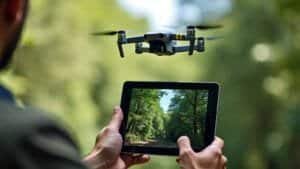
Another exciting development is the integration of GPS telemetry with remote sensing tools like satellite imagery and drones. By combining ground-level movement data with aerial habitat assessments, conservationists can create more comprehensive models of red panda ecosystems, identifying risks and opportunities for conservation at a landscape scale
Telemetry also has the potential to inform climate change adaptation strategies. By tracking how red pandas adjust their ranges in response to changing temperatures or bamboo availability, researchers can predict future habitat needs and guide proactive conservation efforts
Success Stories From GPS Telemetry in Conservation
Numerous conservation programs have successfully used GPS telemetry to protect red pandas. For instance, in Bhutan, telemetry studies helped identify a critical corridor linking two national parks, leading to the establishment of a protected area that ensures safe movement for red pandas and other wildlife
In Nepal, GPS tracking data influenced the design of community-based forest management plans, ensuring that key red panda habitats were preserved while supporting sustainable livelihoods for local residents
These initiatives demonstrate how telemetry data can bridge the gap between research and action, delivering tangible benefits for both wildlife and people
By applying GPS telemetry insights to conservation planning, researchers and policymakers can safeguard the habitats and connectivity that red pandas need to thrive. These efforts are essential for ensuring the long-term survival of this charismatic and vulnerable species
Conclusion
GPS telemetry has transformed the study of red panda movements, offering precise data on their habitat use, migration patterns, and responses to environmental challenges
This technology has provided critical insights into their home ranges, seasonal behaviors, and preferences for bamboo-rich forests, informing conservation strategies to protect this endangered species
Applications of GPS telemetry extend beyond research, enabling targeted habitat restoration, the design of migration corridors, and the mitigation of human-wildlife conflict
By identifying critical areas for protection and understanding how red pandas navigate fragmented landscapes, telemetry data empowers conservationists to address the specific challenges these animals face
As GPS technology continues to evolve, its potential to enhance red panda research and conservation grows. Future advancements, such as integrating telemetry with remote sensing tools, will provide even more comprehensive insights into their ecological needs
By leveraging these innovations, we can ensure that red pandas have the resources and space they need to thrive in the wild for generations to come