Introduction
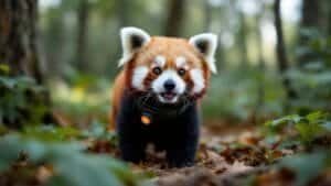
Satellite technologies are transforming red panda habitat conservation by enabling precise monitoring of remote Himalayan forests
From tracking forest health to identifying deforestation and habitat fragmentation, satellites provide invaluable data to conservationists, helping them protect and restore red panda habitats effectively
This article examines the types of satellite technology used in red panda habitat tracking, how satellite data supports conservation, real-world applications, and the future potential of satellite monitoring in conserving red panda populations and their ecosystems
Types of Satellite Technologies Used in Habitat Tracking
Satellite technology offers powerful tools for monitoring red panda habitats, especially in remote, rugged Himalayan regions
Various types of satellites, including remote sensing, GPS, and high-resolution imaging satellites, provide detailed data on forest health, habitat changes, and environmental threats
Here, we explore the primary satellite technologies used to track red panda habitats and how they contribute to effective conservation
Remote Sensing for Habitat Analysis
Remote sensing is one of the primary methods for observing red panda habitats, as it enables scientists to gather data over large areas without physical presence
This technology uses satellites equipped with sensors to detect electromagnetic radiation reflected from Earth’s surface, providing information on vegetation density, soil moisture, and overall habitat quality
According to Li et al. (2020), remote sensing has become essential for tracking red panda habitats, as it offers real-time updates on forest cover, allowing scientists to monitor habitat changes quickly
Remote sensing data is particularly valuable for assessing the overall health of forests, where red pandas rely heavily on dense bamboo understories
The technology allows researchers to measure plant health indicators, like chlorophyll content and leaf moisture, which indicate habitat quality for red pandas. With this information, conservationists can respond more effectively to habitat degradation and identify areas in need of restoration
GPS and High-Resolution Imaging Satellites
High-resolution imaging satellites provide detailed visuals of red panda habitats, showing features as specific as individual trees and patches of bamboo
GPS-equipped satellites contribute precise geographical data that allows scientists to map red panda habitats accurately, track changes over time, and analyze habitat connectivity
Imaging satellites, like those from the Landsat and Sentinel programs, offer high-resolution images that reveal the structure and density of forests, highlighting critical habitats and identifying fragmented areas
For instance, in northeastern India, where red panda habitats are at risk from agricultural expansion, high-resolution images from GPS-enabled satellites have helped conservationists map regions affected by human activity and plan restoration projects accordingly
Sharma & Roberts (2021) report that these images provide critical insights into habitat fragmentation, allowing researchers to assess which areas need immediate intervention to maintain habitat connectivity
Monitoring Tools for Forest Density and Health
Satellite-based monitoring tools that track forest density and health are instrumental for red panda conservation. Using light detection and ranging (LiDAR) technology, satellites measure forest canopy heights, biomass density, and other structural details of the forest
These measurements are essential for understanding the quality of red panda habitats, as they provide data on the availability of shelter, food sources, and corridors for movement
LiDAR technology has proven especially useful in dense bamboo forests, as it penetrates the canopy to capture accurate images of understory growth where red pandas forage
Wang et al. (2019) demonstrated that LiDAR can map forest fragmentation and vegetation loss with high accuracy, highlighting regions that are at risk of becoming isolated due to human activity. With this data, conservationists can focus on protecting critical habitat corridors that are essential for red panda populations to thrive
These satellite technologies offer a comprehensive view of red panda habitats, from overall forest health to fine-scale changes in vegetation. By integrating remote sensing, GPS, and LiDAR data, scientists can build an accurate picture of red panda habitats and respond to environmental threats with timely, targeted conservation efforts
How Satellite Data Supports Red Panda Conservation
Satellite data has become an essential resource in red panda conservation, offering detailed insights into deforestation, habitat fragmentation, and the effects of climate change on their environments
This data helps conservationists identify priority areas for restoration and create more effective management strategies. Below, we explore how satellite data contributes to monitoring deforestation, assessing climate impacts, and directing restoration efforts in red panda habitats
Deforestation and Habitat Fragmentation Detection
Satellite imagery allows conservationists to detect deforestation and habitat fragmentation in real-time. By continuously monitoring red panda habitats, satellites help identify areas where forest cover is declining due to logging, agricultural expansion, or human settlements
For example, Chen et al. (2022) used satellite imagery to track deforestation rates in regions of Nepal and India, observing the immediate impact on red panda habitats and identifying critical zones in need of protection
Fragmentation data from satellites reveals how forest breaks isolate red panda populations, making it harder for them to access food, shelter, and mates
Satellite data has been instrumental in creating maps that pinpoint fragmented areas, helping conservationists understand where to establish habitat corridors to reconnect isolated patches. These insights allow for targeted interventions that support red panda movement and maintain genetic diversity within populations
Tracking Climate Impacts on Red Panda Habitats
Climate change affects the ecosystems red pandas rely on, altering vegetation patterns, water availability, and seasonal cycles. Satellites help track these changes by monitoring temperature shifts, precipitation patterns, and vegetation health across red panda habitats
Thapa & Davis (2023) used satellite data to assess how changing climate conditions impact bamboo growth, a critical food source for red pandas, particularly during times of drought or extreme weather
Through remote sensing technology, satellites monitor the health of bamboo forests by measuring moisture levels and vegetation density, allowing scientists to anticipate periods of food scarcity
When satellite data indicates reduced bamboo growth due to droughts or shifting rainfall patterns, conservationists can prepare by implementing supplementary feeding programs or enhancing habitat resilience through reforestation with climate-tolerant bamboo species
Identifying Priority Areas for Restoration
Satellite data is vital in identifying areas where habitat restoration would have the most significant impact. By analyzing forest density, soil health, and vegetation cover, satellites help conservationists locate degraded areas that, if restored, would enhance habitat connectivity and support larger red panda populations
Li et al. (2020) found that using satellite data to identify degraded habitats allowed for more strategic bamboo replanting efforts in the Eastern Himalayas, targeting areas where restoration would benefit red pandas most
In addition, satellite data allows conservationists to monitor the success of restoration efforts over time. After a restoration project is implemented, satellite imagery provides updates on forest regrowth, vegetation density, and habitat connectivity, ensuring that restoration goals are met and that red panda populations have adequate resources to thrive
By detecting deforestation, tracking climate impacts, and guiding restoration, satellite data provides a powerful, ongoing resource for red panda conservation
With these tools, conservationists can proactively address threats, respond to habitat changes, and prioritize restoration efforts, ultimately helping to secure a sustainable future for red pandas and their habitats
Real-World Applications of Satellite Monitoring
Satellite technology is being applied in red panda conservation through specific programs and initiatives focused on protecting and restoring habitats
These applications not only provide critical data for tracking habitat conditions but also contribute directly to conservation planning. Here, we look at satellite programs dedicated to red panda habitats, the role of satellite data in conservation strategies, and successful case studies where satellite monitoring has made a measurable impact
Specific Programs Focused on Red Panda Habitats
Several satellite programs support red panda conservation by providing high-resolution imagery and habitat data. Programs such as NASA’s Landsat series and the European Space Agency’s Sentinel satellites offer essential tools for monitoring changes in red panda habitats
The Landsat program, which has been collecting data since 1972, provides ongoing imagery that allows conservationists to assess long-term trends in forest cover and habitat health. Sentinel satellites contribute by providing higher-frequency updates, which help researchers detect seasonal changes and human-induced disturbances quickly
These satellite programs are complemented by partnerships with conservation organizations, such as the Red Panda Network, which uses this data to inform restoration efforts and protect vulnerable habitats
The combination of global satellite programs and local conservation efforts ensures that habitat data is both accessible and actionable for conservationists working directly in red panda regions
Role of Satellite Data in Conservation Planning
Satellite data is integral to red panda conservation planning, as it provides a reliable, comprehensive view of habitat conditions across vast areas
With satellite insights, conservation organizations can map areas at high risk of deforestation or degradation, allowing them to allocate resources effectively
For example, data from the Sentinel program has been used to prioritize habitat corridors in Nepal, where satellite data revealed critical areas of fragmentation that would benefit from connectivity efforts
Satellite data also plays a role in setting conservation goals and tracking progress. Conservation planners can establish measurable objectives based on forest density, habitat connectivity, and bamboo availability, using satellite imagery to gauge success over time
This approach ensures that conservation efforts are adaptive and responsive to current habitat conditions, creating more effective protection strategies for red pandas
Case Studies of Successful Satellite Tracking
Real-world case studies illustrate the effectiveness of satellite monitoring in protecting red panda habitats. In northeastern India, for instance, the WWF used Landsat data to identify deforested areas within protected red panda territories
By analyzing this data, conservationists implemented targeted reforestation programs, planting native bamboo species in degraded areas to restore habitat connectivity. Within a few years, these efforts showed increased red panda sightings, indicating a successful recovery of the habitat and a positive impact on red panda populations
Another successful application of satellite data occurred in Bhutan, where researchers combined Sentinel satellite imagery with ground-based monitoring to map critical red panda habitats at risk of climate-induced drought
This combined approach allowed conservationists to pinpoint areas for drought-resistant bamboo planting, reducing the risk of food shortages during dry seasons
The Thapa & Davis (2023) study concluded that red panda populations in these areas showed improved resilience to climate variability, demonstrating the value of satellite-guided restoration efforts
By leveraging satellite programs, conservation planning, and field applications, satellite monitoring has become a powerful tool in safeguarding red panda habitats
These case studies underscore the role of satellite data in achieving tangible conservation outcomes, highlighting its potential for ongoing and future red panda protection efforts
Challenges and Future Directions in Satellite Monitoring
While satellite technologies have significantly advanced red panda conservation, there are challenges in ensuring accuracy and in accessing high-resolution data for remote habitats
Additionally, evolving technologies, such as artificial intelligence (AI) and machine learning, offer new possibilities for overcoming these limitations
Here, we explore the challenges of satellite monitoring in rugged red panda habitats, potential improvements in imagery and analysis, and the future prospects for satellite-assisted conservation
Accuracy and Limitations in Remote Regions
Tracking red panda habitats in the dense, mountainous forests of the Eastern Himalayas presents unique challenges for satellite monitoring. Thick canopy cover and steep terrain can obscure satellite views, making it difficult to obtain clear images of the forest understory where red pandas forage
Additionally, cloud cover during the monsoon season can further reduce the availability of usable images, complicating year-round monitoring efforts
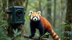
To address these challenges, researchers are using a combination of satellite data and ground-based observations. By cross-referencing satellite images with data collected on the ground, conservationists can improve accuracy and account for gaps in imagery
LiDAR technology, which penetrates forest canopies to capture detailed images of the understory, is another valuable tool for overcoming these limitations, though it is still limited in its accessibility and cost
Improvements in High-Resolution Imagery and AI Analysis
Advancements in satellite imagery, including higher-resolution cameras and more frequent data collection, are improving the precision of habitat monitoring
Newer satellites, such as those in the Planet Labs constellation, provide high-resolution images multiple times per day, offering more detailed and timely data. These updates allow conservationists to detect subtle changes in vegetation and soil health, as well as to respond faster to threats such as illegal logging or forest fires
AI and machine learning are also transforming how satellite data is analyzed. Algorithms can now identify patterns and anomalies in large datasets, automating the detection of deforestation, forest degradation, and even seasonal changes in bamboo growth
In recent projects, AI has been used to track changes in red panda habitats over time, reducing the time required to analyze data and increasing the accuracy of habitat assessments
Chen et al. (2022) highlighted the effectiveness of AI in pinpointing deforested areas, allowing rapid response in regions where red panda habitats are under threat
Future Prospects for Satellite-Assisted Conservation
The future of satellite-assisted red panda conservation looks promising, with new technologies and collaborative projects paving the way for more comprehensive habitat monitoring
The integration of AI-driven analysis, LiDAR data, and regular high-resolution satellite imagery will allow conservationists to track habitat conditions more accurately and address threats more proactively
Partnerships between conservation organizations, governments, and technology companies will play a vital role in ensuring that conservationists have access to the latest satellite technologies
One promising development is the potential for habitat modeling, where satellite data is used to create simulations that predict how red panda habitats might change under different climate and land-use scenarios
This approach will help conservationists prepare for long-term habitat changes and develop strategies that protect red panda habitats against future threats
With these advancements, satellite monitoring will continue to evolve as an essential tool in red panda conservation, enabling more precise and effective protection strategies for this endangered species
By overcoming current limitations and leveraging new technologies, satellite-assisted conservation holds immense potential to safeguard red panda habitats for generations to come
Conclusion
Satellite technologies have become invaluable in red panda conservation, offering unparalleled insights into habitat conditions, forest health, and environmental threats across the remote Himalayan landscapes
By leveraging tools such as remote sensing, high-resolution imaging, and LiDAR, conservationists can detect deforestation, monitor climate impacts, and identify priority areas for restoration
Satellite data enables timely, strategic actions that are critical for preserving red panda habitats, which are increasingly threatened by climate change and human encroachment
Despite challenges like dense canopy cover and limited access to real-time data in rugged terrains, advancements in high-resolution imaging and AI-powered data analysis continue to improve the precision and efficiency of satellite monitoring
Through partnerships with technology providers and local conservation groups, these innovations are making it possible to address threats proactively and adapt to changing conditions in red panda habitats
Looking forward, satellite-assisted conservation will play an essential role in red panda protection. With new technologies and predictive modeling, conservationists are better equipped than ever to safeguard these unique habitats
As these efforts evolve, satellite monitoring will remain at the forefront of effective, data-driven strategies to ensure red pandas and their ecosystems are preserved for future generations