Introduction
Drones are revolutionizing red panda population monitoring by providing researchers with an efficient way to track, observe, and analyze these elusive animals in dense forest environments
Traditional methods for monitoring red pandas are often limited by difficult terrain and limited visibility, but drones equipped with advanced technologies like thermal imaging and GPS tracking now make it possible to study red panda populations with greater accuracy and minimal disturbance
This article explores the advantages of drones in red panda conservation, examining how they enhance data collection, improve habitat analysis, and support conservation efforts in remote areas
Benefits of Drones in Red Panda Monitoring
Drones offer substantial benefits for monitoring red panda populations by providing enhanced access, data accuracy, and reduced disturbance compared to traditional methods
With the ability to navigate dense forests and difficult terrain, drones allow researchers to gather comprehensive data on red panda habitats, population size, and movement patterns
These improvements help conservationists make informed decisions to protect red pandas and their ecosystems effectively
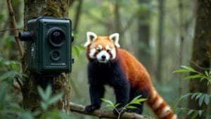
Efficient Tracking in Dense Forests
Red pandas are naturally elusive and live in dense, mountainous forests, making them challenging to track from the ground
Drones equipped with high-resolution cameras and GPS systems can navigate these forests from above, covering large areas more efficiently than on-foot tracking. By flying over forest canopies, drones provide an aerial perspective that allows researchers to identify red panda locations and movement patterns without disturbing their natural behaviors
This capability saves time and resources, allowing researchers to gather data over wider areas in shorter periods
Thapa and Sherpa (2023) found that drones improve red panda tracking accuracy, making it easier to monitor population changes and pinpoint critical habitats where conservation efforts should be focused
Enhanced Data Collection and Analysis
Drones equipped with advanced imaging technologies, such as thermal and infrared sensors, enable researchers to collect more detailed data on red pandas and their habitats
Thermal imaging, for example, detects heat signatures, making it easier to locate red pandas even when they are hidden in dense foliage or resting in tree canopies. This non-intrusive approach ensures that red pandas are monitored without being disturbed, providing more reliable behavioral data
By capturing images and video footage, drones also allow researchers to analyze red panda behaviors, feeding patterns, and interactions with their environment in real-time
This data can be processed to create more accurate population estimates, track seasonal movements, and monitor habitat preferences, giving conservationists a deeper understanding of red panda ecology
Accurate Population and Habitat Assessments
One of the most significant benefits of using drones is their ability to provide accurate and repeatable population assessments. Traditional methods of population assessment often involve physical tracking, which is labor-intensive and prone to error in rugged terrains
Drones, on the other hand, offer consistent monitoring over time, allowing researchers to conduct regular population surveys and detect trends
Drones also enhance habitat assessments by capturing detailed images of the forest structure, vegetation density, and bamboo availability, which are critical resources for red pandas
This data enables conservationists to assess habitat health and detect changes over time, such as deforestation or habitat fragmentation, which directly impact red panda populations. By combining population and habitat assessments, drones support a more holistic approach to red panda conservation
Technologies and Tools Used in Drone Monitoring
To monitor red pandas effectively, drones are equipped with advanced technologies that improve accuracy and data collection capabilities
These tools include thermal imaging, GPS tracking, and high-resolution cameras, allowing researchers to gather critical information about red panda habitats and behaviors. With these tools, drones can offer unique insights into red panda ecology, even in the challenging terrain of the Himalayan forests
Thermal Imaging for Detecting Red Pandas
Thermal imaging has become a valuable tool in red panda monitoring, as it allows researchers to detect heat signatures from animals hidden within dense vegetation
Unlike visible-light cameras, thermal imaging sensors can identify red pandas based on body heat, making it easier to locate them in heavily forested or low-light conditions. This technology reduces the need for ground tracking, which can disturb red pandas and lead to inaccurate data
Using thermal imaging, researchers can monitor red panda activity throughout the day and even at night, gaining insights into their rest periods, feeding times, and other behaviors. This method has been particularly effective in identifying red pandas in thick bamboo forests, where visual detection is difficult
GPS and AI-Powered Tracking Systems
Drones equipped with GPS and AI-powered tracking systems enhance researchers’ ability to monitor red pandas over extended periods
GPS data allows drones to map out red panda territories, track their movement patterns, and identify frequently used trails or feeding areas. This information helps conservationists understand red pandas’ spatial needs and how they navigate their environment
AI-powered tracking systems can also analyze footage in real-time, identifying red pandas based on unique markings or behaviors. This technology streamlines data collection by reducing the need for manual observation and enabling drones to automatically detect and record red pandas, saving time and increasing the accuracy of population counts
High-Resolution Cameras for Habitat Analysis
High-resolution cameras provide detailed images of red panda habitats, capturing the structure of forest canopies, vegetation types, and potential threats like deforested areas
These images help conservationists assess habitat quality, track changes over time, and identify regions at risk of degradation. By capturing visual data, researchers can analyze the availability of bamboo, tree cover, and other resources essential to red panda survival
High-resolution imagery also supports 3D mapping of the terrain, allowing for a more in-depth analysis of the landscape features that influence red panda behavior. With this information, conservationists can make data-driven decisions on habitat protection, restoration, and connectivity projects that support red panda populations
Drones in Habitat and Behavior Analysis
Drones provide a unique vantage point for studying red panda habitats and behaviors, enabling researchers to gather valuable data on environmental changes and red panda activity patterns
By using drones to monitor changes in forest cover, observe behavior, and assess resources, conservationists can make better-informed decisions to protect and sustain red panda populations
Mapping Forest Changes Over Time
One of the primary uses of drones in red panda habitat analysis is monitoring changes in forest cover over time. Drones capture high-resolution images and videos of red panda habitats, documenting the extent and density of forested areas
By comparing drone footage from different periods, researchers can detect deforestation, habitat fragmentation, and other environmental changes that may threaten red panda survival
This data allows conservationists to respond to habitat degradation more effectively, as they can identify areas that need reforestation or protection
Continuous mapping also helps measure the impact of conservation initiatives, such as reforestation projects, on red panda habitats, ensuring that conservation strategies are yielding positive results
Observing Red Panda Activity Patterns
Drones equipped with thermal imaging and high-resolution cameras enable researchers to observe red panda activity patterns from a safe distance, minimizing disturbances to their natural behaviors
By monitoring red pandas as they forage, rest, and navigate their environment, researchers gain insights into daily routines and seasonal behaviors. These observations help identify red panda feeding preferences, resting sites, and movement patterns across their territories
Behavioral data collected by drones reveal how red pandas interact with their habitat and respond to environmental changes. For instance, drones can track red panda movements in response to food availability or temperature shifts, providing a clearer understanding of how seasonal changes affect red panda behavior and survival
Assessing Food and Shelter Resources
Drones help conservationists assess the availability of key resources, such as bamboo groves and tree cover, within red panda habitats
By capturing detailed images of bamboo density and tree species diversity, drones provide data on food sources and potential shelter sites, which are essential for red panda survival. This information enables researchers to evaluate the carrying capacity of habitats and identify areas that may require restoration
Data on food and shelter availability also guide habitat management practices, ensuring that red panda territories are well-maintained and capable of supporting healthy populations. This habitat assessment is especially important in fragmented landscapes, where food and shelter resources may be unevenly distributed
Challenges and Ethical Considerations
While drones provide valuable tools for red panda monitoring, their use also comes with challenges and ethical considerations
Factors like potential disturbances to red panda behavior, technical limitations, and environmental regulations must be carefully managed to ensure that drone usage supports conservation efforts without causing unintended harm
Drone Impact on Red Panda Behavior
One of the main ethical concerns with drone usage is the potential for drones to disturb red pandas in their natural environment. The noise from drones can disrupt red panda activities, especially in densely forested areas where animals are not accustomed to loud sounds
Studies by Wu and Li (2020) suggest that even small, unobtrusive drones may alter red panda behavior if they fly too closely or frequently in their vicinity
To minimize disturbances, researchers set guidelines for drone altitude, speed, and flight frequency to ensure that red pandas are not disrupted by monitoring efforts
By adhering to these ethical guidelines, conservationists can balance the benefits of drone monitoring with the welfare of red pandas in their natural habitats
Technical and Environmental Limitations
Operating drones in mountainous, forested regions poses technical challenges, including limited battery life, difficult navigation, and potential interference from dense foliage
High-altitude environments, where red pandas often reside, can also impact drone performance due to reduced air pressure and unpredictable weather conditions. These limitations may restrict the duration and coverage of drone flights, affecting the consistency of data collection
Environmental factors such as wind, rain, and forest density require researchers to carefully plan drone flights, often resulting in higher costs and more complex logistical needs. Addressing these technical limitations is essential for ensuring reliable and accurate data collection in red panda habitats
Regulations for Drone Use in Protected Areas
Drone use in protected areas is regulated to prevent disruption to wildlife and preserve the natural environment
In many regions where red pandas live, strict regulations govern drone operations, including flight restrictions in wildlife reserves and national parks. These rules help maintain ecosystem integrity and reduce the potential impact of drones on sensitive habitats
Conservationists must obtain permits and adhere to local guidelines when using drones in protected areas, ensuring that all drone activities comply with environmental laws
By following these regulations, researchers contribute to a responsible approach to conservation that respects red panda habitats and prioritizes the long-term health of the ecosystem
Conclusion
Drones are transforming red panda conservation by providing efficient and effective tools for monitoring populations, analyzing habitats, and tracking environmental changes
Through technologies like GPS, thermal imaging, and high-resolution cameras, drones allow researchers to gather data in ways that were previously challenging or impossible, especially in the dense, mountainous forests where red pandas reside
This innovative approach improves population estimates, enhances habitat assessments, and supports long-term conservation strategies
Despite these benefits, drone use comes with challenges and ethical considerations, including potential disturbances to red panda behavior, technical limitations, and regulatory requirements in protected areas
Addressing these factors ensures that drones are used responsibly, minimizing their impact on red panda habitats while maximizing their conservation potential. As technology continues to advance, drones are likely to play an increasingly important role in wildlife conservation, offering valuable insights that help protect endangered species like the red panda and the delicate ecosystems they inhabit